Global Navigation Satellite System (GNSS) technology has become a cornerstone of modern agriculture, particularly in the realm of precision agriculture tools. By allowing for precise location tracking and spatial awareness, GNSS has revolutionized how farmers manage their land, streamline operations, and optimize yields. One critical application of this technology is in land leveling, which is essential for maximizing irrigation efficiency and promoting healthy crop growth.
The Role of GNSS Technology in Precision Agriculture
GNSS technology enables farmers to achieve unprecedented accuracy in field operations. By providing real-time geolocation data, GNSS allows precision agriculture tools to operate effectively, ensuring that all farming activities—ranging from planting to harvesting—are executed with high precision.
In terms of land leveling, GNSS technology provides farmers with the ability to monitor and adjust soil elevation across their fields accurately. Proper leveling helps prevent water pooling, reduces soil erosion, and optimizes irrigation practices. An effective land leveling strategy facilitates uniform water distribution, which is vital for crop health and overall productivity.
Benefits of Using GNSS for Land Leveling
The integration of GNSS technology into land leveling offers numerous benefits, particularly when it comes to enhancing precision agriculture tools. The most significant advantage is the increase in efficiency. Automated leveling systems equipped with GNSS technology can continuously monitor elevation changes in real time, allowing for immediate adjustments to be made to the blades or scrapers on land leveling machinery. This automation reduces the need for manual intervention and speeds up the leveling process.
Additionally, GNSS-based land leveling minimizes input costs. By ensuring that fields are level and irrigation is evenly distributed, farmers can significantly reduce water usage and enhance resource management. Efficient irrigation not only lowers operational costs but also helps maintain soil health, ultimately leading to better crop yields.
Moreover, the accuracy provided by GNSS technology helps to address issues related to soil compaction and erosion. By leveling land effectively, farmers can create a more stable environment for crops, reducing the risk of yield loss due to adverse weather conditions.
Conclusion
As agriculture continues to evolve, the role of GNSS technology in providing precision agriculture tools becomes increasingly crucial. The ability to accurately level land and improve irrigation practices leads to more efficient farming operations and better resource management.
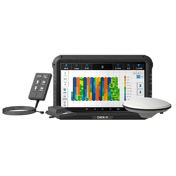
At CHCNAV Agriculture, we are dedicated to advancing agricultural practices through innovative solutions. Our IC100 automated GNSS land leveling system integrates cutting-edge GNSS RTK technology with electro-hydraulic controls. By monitoring elevation changes in real time, the IC100 ensures precise land leveling and enhances irrigation efficiency, providing significant value to farmers. With our commitment to optimizing precision agriculture tools, we aim to support farmers in achieving sustainable productivity and success in their operations.
